Africa Map with Countries and Capitals
Ready to explore the continent of Africa? Dive into this map of Africa with countries and cities. We allow you to download for free and use any map of Africa.
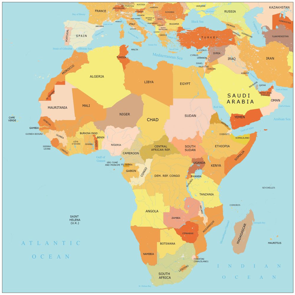
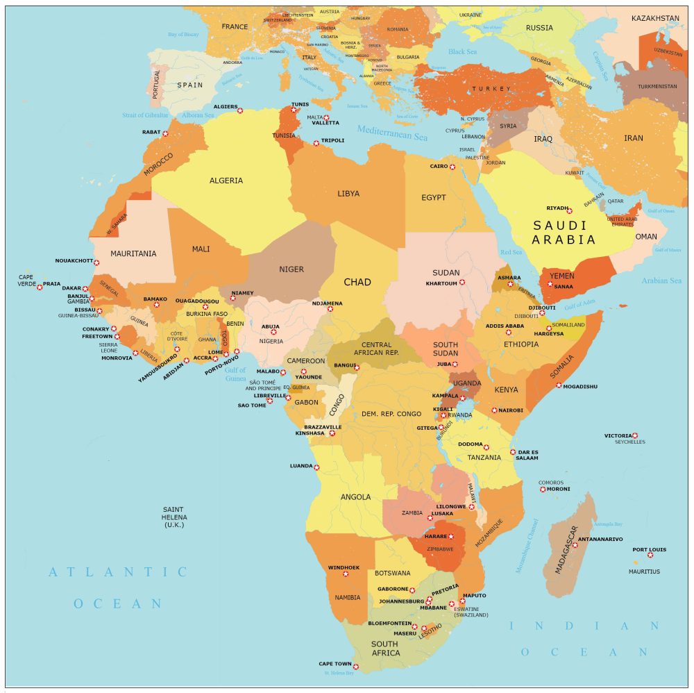
Africa Map with Capital Cities
We bring you two different flavors. The first map shows a map of Africa with countries. The next one includes capital cities for each African country.
Remember that you can download both maps for free. Please cite our page as a reference as the originator of this map of Africa.
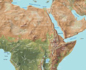
Africa in Our World Atlas
Want to learn about all the countries in Africa? If you do, you should check out our world atlas.
It divides Africa into eastern, middle, northern, southern, and western Africa. Most African maps in our atlas include a political, satellite, and administration map.
Jump To: Eastern Africa | Middle Africa | Northern Africa | Southern Africa | Western Africa
Eastern Africa


Middle Africa


Northern Africa


Southern Africa


Countries in Africa
According to the United Nations, Africa has 54 countries. Here’s a bit of background of the continent of Africa that lists each country in a table. We also include the country’s location on the mainland of Africa.
| Country | Description |
|---|---|
| Algeria | North Africa, Mediterranean coastline. |
| Angola | Southern Africa, Atlantic Ocean coast. |
| Benin | West Africa, Gulf of Guinea. |
| Botswana | Southern Africa, landlocked. |
| Burkina Faso | West Africa, inland. |
| Burundi | East Africa, Great Rift Valley. |
| Cabo Verde | West Africa, Atlantic island chain. |
| Cameroon | Central Africa, Gulf of Guinea. |
| Central African Rep. | Central Africa, landlocked. |
| Chad | Central Africa, Sahara Desert. |
| Comoros | Indian Ocean, off East Africa. |
| Congo (Brazzaville) | Central Africa, Congo River basin. |
| Congo (Kinshasa) | Central Africa, Congo River basin. |
| Cote d’Ivoire | West Africa, Gulf of Guinea. |
| Djibouti | East Africa, Red Sea coastline. |
| Egypt | North Africa, Nile River valley. |
| Equatorial Guinea | Central Africa, Gulf of Guinea. |
| Eritrea | East Africa, Red Sea coastline. |
| Eswatini | Southern Africa, landlocked. |
| Ethiopia | East Africa, Great Rift Valley. |
| Gabon | Central Africa, Gulf of Guinea. |
| Gambia | West Africa, Atlantic Ocean coast. |
| Ghana | West Africa, Gulf of Guinea. |
| Guinea | West Africa, Atlantic Ocean coast. |
| Guinea-Bissau | West Africa, Atlantic Ocean coast. |
| Kenya | East Africa, Great Rift Valley. |
| Lesotho | Southern Africa, landlocked. |
| Liberia | West Africa, Atlantic Ocean coast. |
| Libya | North Africa, Sahara Desert. |
| Madagascar | Indian Ocean, off Southeast Africa. |
| Malawi | East Africa, landlocked. |
| Mali | West Africa, Sahara Desert. |
| Mauritania | West Africa, Sahara Desert. |
| Mauritius | Indian Ocean, off East Africa. |
| Morocco | North Africa, Atlantic Ocean coast. |
| Mozambique | Southeast Africa, Indian Ocean coast. |
| Namibia | Southern Africa, Atlantic Ocean coast. |
| Niger | West Africa, Sahara Desert. |
| Nigeria | West Africa, Gulf of Guinea. |
| Rwanda | East Africa, Great Rift Valley. |
| Sao Tome and Principe | Gulf of Guinea, off West Central Africa. |
| Senegal | West Africa, Atlantic Ocean coast. |
| Seychelles | Indian Ocean, off East Africa. |
| Sierra Leone | West Africa, Atlantic Ocean coast. |
| Somalia | East Africa, Horn of Africa. |
| South Africa | Southern Africa, Indian and Atlantic. |
| South Sudan | East Africa, landlocked. |
| Sudan | East Africa, Nile River valley. |
| Tanzania | East Africa, Great Rift Valley. |
| Togo | West Africa, Gulf of Guinea. |
| Tunisia | North Africa, Mediterranean coastline. |
| Uganda | East Africa, Great Rift Valley. |
| Zambia | Southern Africa, landlocked. |
| Zimbabwe | Southern Africa, landlocked. |
Disputed Territories
There are several disputed territories in Africa. Some notable examples include Western Sahara, Abyei, and the border areas between Sudan and South Sudan.
| Disputed Territory | Description |
|---|---|
| Western Sahara | Located in North Africa, bordered by Morocco and Mauritania, along the Atlantic coastline. |
| Abyei | Abyei is a region situated on the border between Sudan and South Sudan, in East Africa. |
| Sudan and South Sudan | These border areas are located in East Africa, marking the boundary between Sudan and South Sudan. |
Atlas of Africa
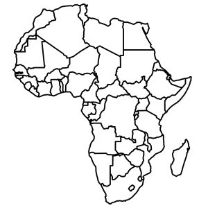
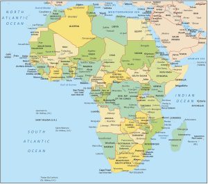
In search of a map of Africa? Our assortment of African maps features a variety of types, from physical maps to clear country outlines, and straightforward continental overviews. To explore these options, just click on any of the maps displayed below.
Thanks, these are wonderful!